Intermunicipal Development Plan (IDP)

What is an IDP?

An Intermunicipal Development Plan (IDP) is a plan developed jointly by two or more neighbouring municipalities to manage land use and development decision-making for an area of land in close proximity to their shared boundary. The IDP is a statutory plan, required under the Municipal Government Act (MGA). It is meant to facilitate efficient and compatible land development by addressing:

  1. Future land use and the process coordinating the review of future development proposals in the area,
  2. Environmental matters as well as social, physical or economic development matters,
  3. Co-ordination and financing of intermunicipal programs, services, facilities, and infrastructure,
  4. Procedures for conflict resolution and amending or repealing the plan, and
  5. Administrative matters related to the plan.

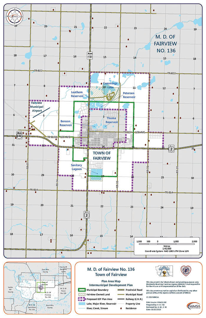
The IDP is between the Town and the MD of Fairview.

The IDP Area, also known as the Joint Planning Area, is adjacent to the boundary between the MD and the Town. It covers an area of approximately 28.16 km². It is represented by the white background in the map below. Some of the key features and landmarks located in the IDP Area include the Sanitary Lagoon, Cummings Lake, the Peterson Reservoir and the Fairview Municipal Airport.

Download Map

Apart from being a mandatory plan required by the Province, the value of creating an IDP with the MD is that the plan will:

  • ensure that physical development occurs along the shared boundaries between the two municipalities in a coherent and orderly manner, mitigating the threat of incompatible land uses and conflicting developments;
  • provide a framework for the Town and the MD to work together on issues such as procedures for land annexation and the provision and management of shared infrastructure, resources and services (e.g., transportation, water supply, parks); and
  • foster greater collaboration between the two municipalities, both at the institutional and community level.